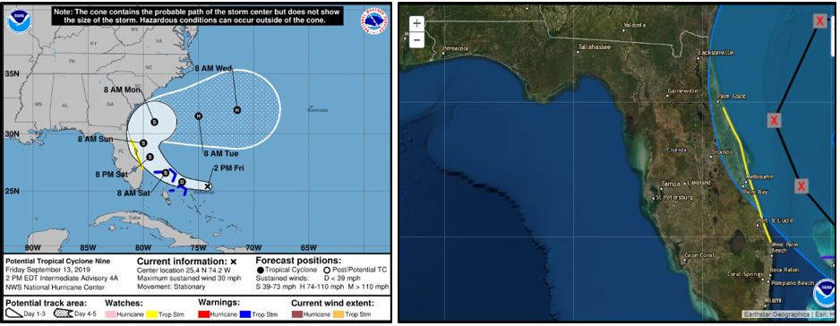
Potential Tropical Cyclone 9 is currently located about 280 miles ESE of Freeport Grand Bahama Island. Sustained wind speeds are 30 mph, and the system is actually stationary, but is expected to begin moving NW slowly throughout the evening. As expected, conditions continue to shift toward a more conducive environment for tropical cyclone formation as the vertical wind shear moves out of the storm’s path. Over the next day, the storm is expected to intensify into a tropical storm and increase in forward velocity as it tracks over the Bahamas and close to Florida’s east coast. Tropical Storm watches are currently in effect on Florida’s east coast from approximately Daytona Beach to West Palm Beach. A Tropical Storm Watch means that tropical storm conditions are possible in that area within 48 hours.
The track guidance from the forecast models show the system will steer generally northwestward during the next 36 hours or so, then turn to the north and eventually to the northeast as the system moves through a low to mid-level ridge over the southeastern United States. Several of the more reliable forecast models (historically) show the system could begin turning to the north and northwest sooner, which would greatly reduce the risk to Florida, while several other models have the storm moving over the Florida peninsula as a weak system on Sunday. Note, however, that over the last few NHC advisories the mean track has shifted more eastward away from Florida. We will continue to monitor this system and provide additional updates as necessary.