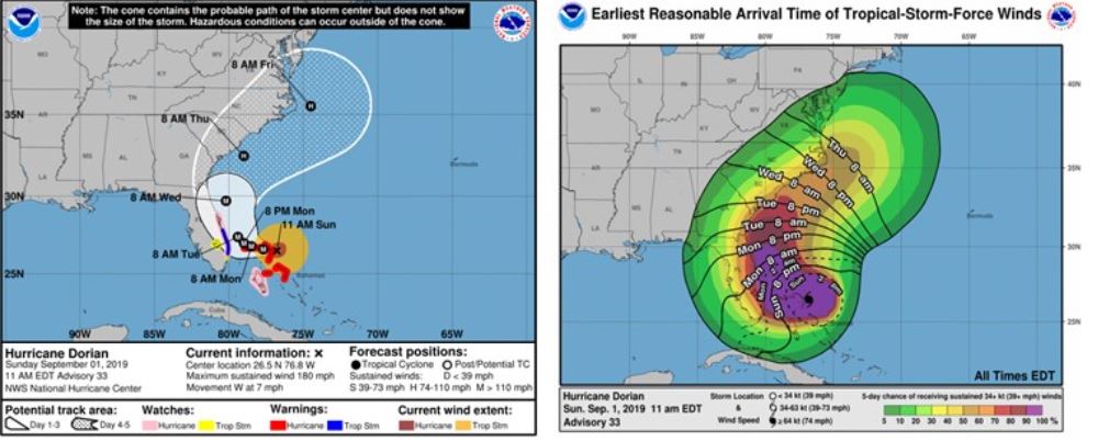

As of 11:00 am EST on September 1, Hurricane Dorian is 205 miles east of West Palm Beach Florida, moving W at 7 mph. Current maximum sustained wind speeds are 180 mph, making it a very strong category 5 hurricane. Over the last few advisories, the NHC continues to forecast a northward turn for Dorian. While the current advisory suggests that Dorian could potentially skirt Florida, it is paramount to remember Florida remains in the cone of uncertainty and conditions could still change. Even this close to landfall, uncertainty is still high.
The operational models continue to show more agreement regarding the likely track the storm will take. However, several ensembles are not forecasting Dorian’s northward turn to be as soon as other models. This is due to a change in the upper level atmospheric steering currents. As these currents to continue to change, they will affect how soon Dorian begins to turn northward. As a result, the NHC has shifted the average track west slightly. If Dorian’s track continues to shift westward, this will create a very different scenario regarding the impact to Florida. The next 24 hours will be critical in determining the storm’s potential impact. Any significant changes to the atmospheric conditions could present an altered landfall scenario.