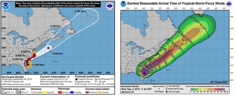

As of 11 am EST on Sept. 4, Hurricane Dorian is currently 90 miles ENE of Daytona Beach, Florida, moving NW at 9 mph. Current maximum sustained wind speeds are 105 mph, making it a moderate category 2 hurricane. Recent satellite imagery of Dorian indicates the cloud tops in the eye-wall have cooled significantly during the past few hours. Unfortunately, reports from an Air Force Reserve Hurricane Hunter aircraft shows that the hurricane’s intensity remains unchanged. As a result of only light to moderate vertical wind shear and warm sea surface temperatures, Dorian is expected to maintain Category 2 intensity as it passes near the southeastern U.S. coast. However, Dorian remains a relatively compact storm with most of the tropical storm force winds remaining over the Atlantic.
Dorian’s forward speed will continue increasing over the next several days as a low-pressure trough swinging out of the continental U.S. will pick it up, push it northeast and accelerate it up the Southeastern U.S. Coast. Overnight Dorian is expected to pivot around the Georgia/Florida border and begin tracking in a northeastwardly direction (still parallel to the coast) toward the Carolinas.
The operational models continue to show very good agreement regarding Dorian’s likely track up the east coast and away from Florida. American Integrity will continue to monitor the storm and provide updates as Dorian continues to move up the Florida coast.