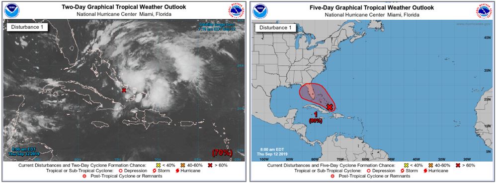
We are currently monitoring the progress of Invest 95L in the Atlantic Basin. Satellite images indicate the area of disturbed weather is currently situated over the central and southeastern Bahamas. While further strengthening of the system is currently being suppressed by a large area of vertical wind shear, conditions continue to shift toward a more conducive environment for tropical cyclone formation. Current reports in the Atlantic indicate maximum sustained winds are 30 mph. The system will not be named until sustained winds reach at least 39 mph (tropical storm strength). Humberto would be the assigned name.
In general, the forecast models show disagreement regarding the likely track of the system. Several models forecast a strikingly similar track as Dorian, while other models show the system crossing the state from southeast to northwest. Given the limited time the system would be able to strengthen, current intensity models forecast only tropical storm force windspeeds will affect the Caribbean and potentially Florida. Regardless of whether the tropical system materializes, it is likely to be a wet weekend for much of the state. Conditions remain highly uncertain and can quickly change, even within a few hours. We will continue to monitor this system and provide additional updates as necessary.